Only rarely does Shinjuku look as magical as it does here in this time-lapse video shot over the course of a year from various locations. The dreamy ambient track is from Cliff Martinez's score for the movie Solaris (2002).
(Thanks, Sam!)
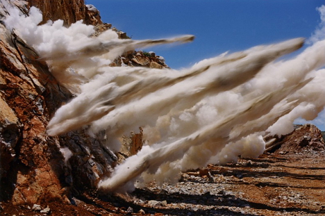
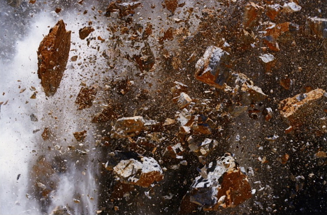
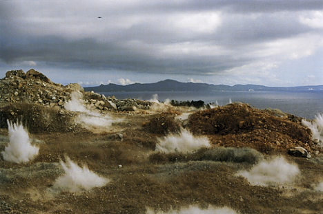
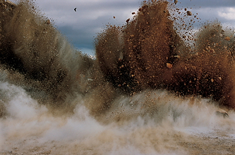
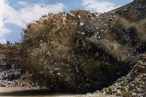
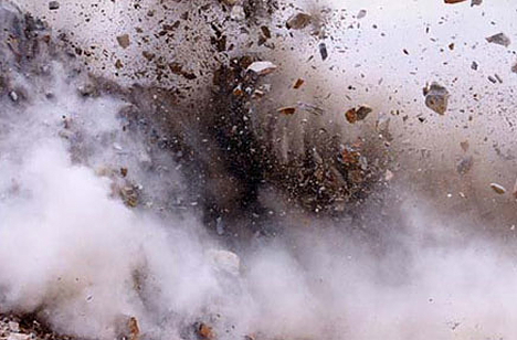
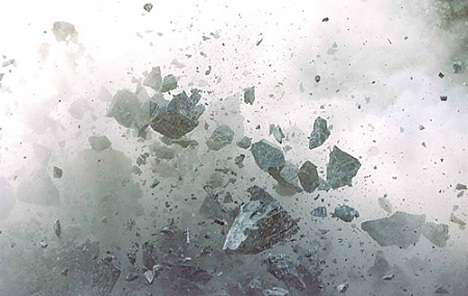
In his "Blast" series of photographs, Naoya Hatakeyama uses remote-control cameras to capture the drama and destruction of Japan's limestone blasting operations from point-blank range.
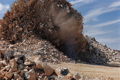
The dangerous, close-up views of exploding debris inspire the viewer to consider the human capacity for destruction, while providing a unique perspective on the instant obliteration of these ancient rock formations.
Hatakeyama began photographing Japan's limestone mining operations in the early 1980s. In 1994, he published Lime Works, a photo book focused on limestone processing facilities.
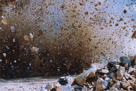
In 1995, he turned his camera toward the detonation side of the mining process, which he has been photographing ever since.
Limestone, a sedimentary rock consisting mainly of calcium carbonate (CaCO3), is one of the few natural resources in which Japan is totally self-sufficient.
It can be argued that Japan's (and the world's) entire way of life is dependent on limestone, a key ingredient in the production of concrete, steel, glass, plastic, and even medicine.
Japan extracts about 200 million tons of limestone from quarries each year, scarring countless mountainsides in the process.
The nation is believed to have an additional 10 billion tons of limestone deposits at its disposal -- enough to last another 50 years at the current rate of consumption.
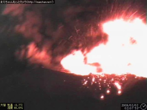
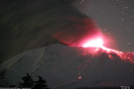
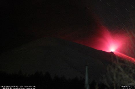
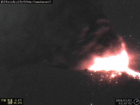
Here is some awesome time-lapse footage of the eruption of Mount Asama, an active volcano straddling the border of Gunma and Nagano prefectures north of Tokyo, which suddenly awoke in the early morning hours of Monday, February 2. The video was shot between 1:55 and 2:30 AM.
- - - - -
Other cameras captured the volcanic activity from different angles. The time-lapse videos below were created from photos shot at 10-minute intervals. The eruption occurs toward the end of each video.
Latest photos of Mt. Asama: 1, 2, 3.
[Link: Maechan.net]
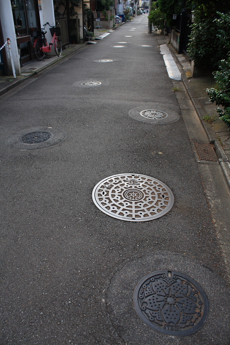
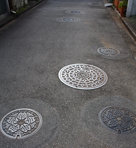
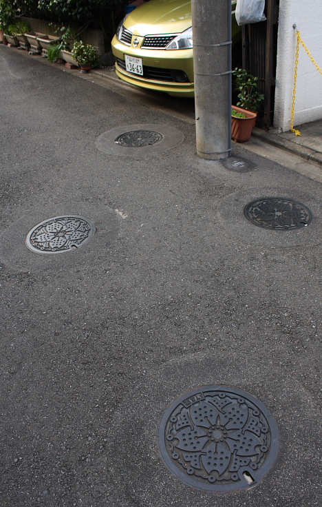
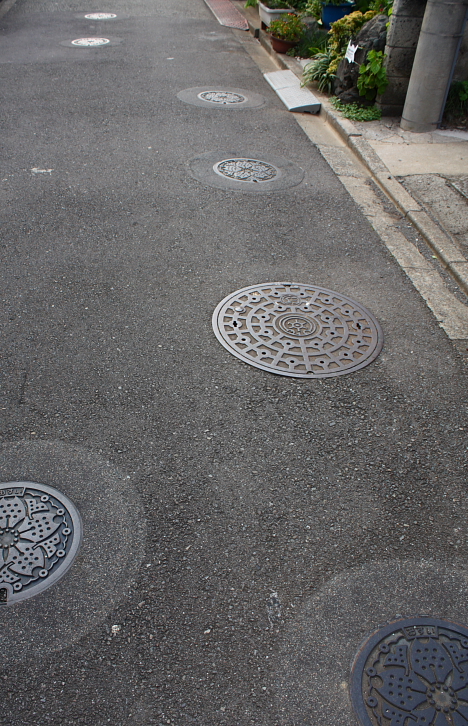
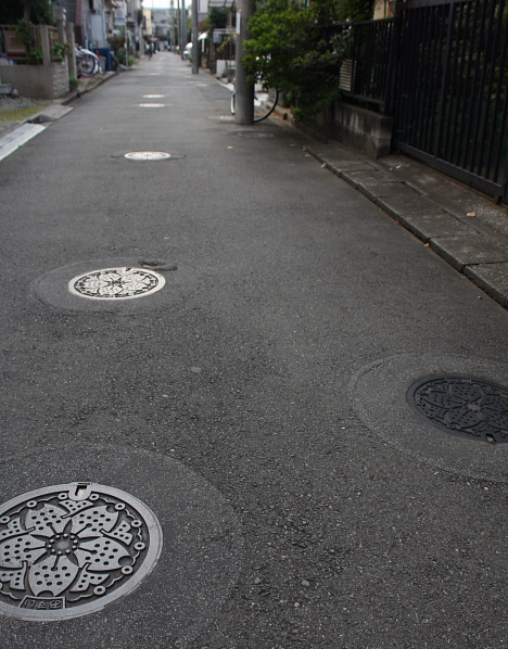
Poor planning? Engineering gone wrong? Unconventional street decor? Whatever the explanation, this quiet residential street in Tokyo's Setagaya ward boasts perhaps the highest manhole density in town, with 85 of them scattered along a 200-meter stretch of pavement. Fans of the curious street call it "Manhole Ginza."
[Link: Google Maps]
Related: Japanese manhole covers
Photographer Shintaro Sato captures beauty in the chaotic Tokyo cityscape viewed from emergency staircases at dusk. Check his site for the full gallery of high-resolution images.
[Link: Tokyo Twilight Zone]
See also:
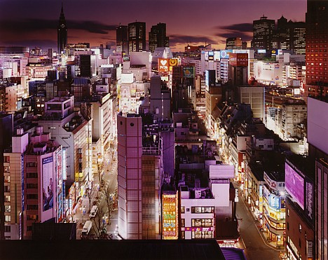
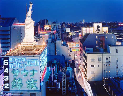
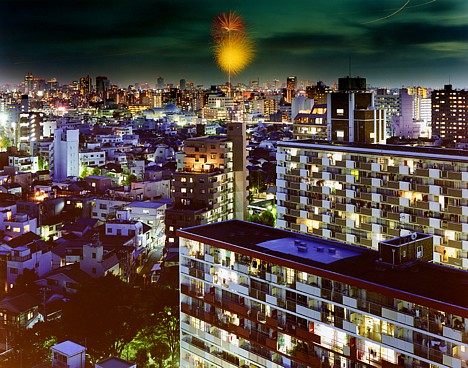
- Suburban Tokyo nightscapes
- Highway interchange photos
- Fantastic Japanscapes
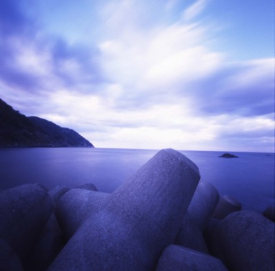
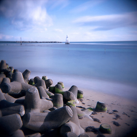
Near Tappi Saki, Aomori (Photo: Mr_M_Montgomery)
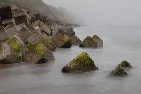
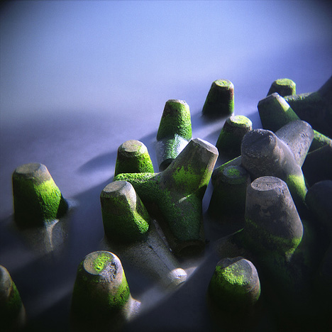
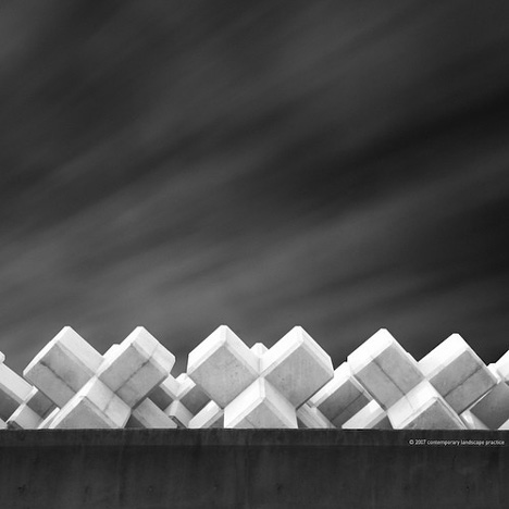
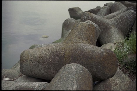
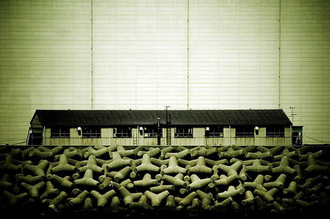
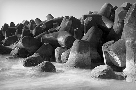
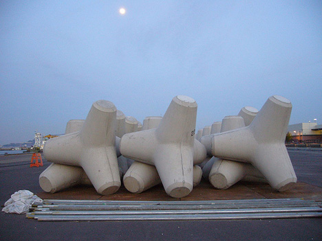
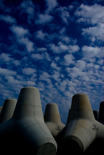
Hit the beach anywhere in Japan, and you are likely to see endless piles of tetrapods -- enormous four-legged concrete structures intended to prevent coastal erosion. By some estimates, more than 50% of Japan?s 35,000-kilometer (22,000-mi) coastline has been altered with tetrapods and other forms of concrete. Critics, who blame the tetrapod invasion on decades of excessive government spending designed to bolster the construction industry, argue that in addition to posing a danger to swimmers, surfers and boaters, tetrapods actually accelerate beach erosion by disrupting the natural processes that shape the coastal environment. Meanwhile, others have developed an aesthetic appreciation of the tetrapod landscape, as evidenced by a host of stunning Japanese tetrapod photos on Flickr.
Location unknown (Photo: saksak)
Location unknown (Photo: f l u x)
Kawasaki (Photo: gullevek)
Kobe (Photo: Joshua Richley)
Hamamatsu, Shizuoka (Photo: seotaro)
Yakushima (Photo: TommyOshima)
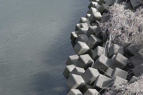
River bank, Shikoku (Photo: kodama)
Amarube (Photo: shikihan)
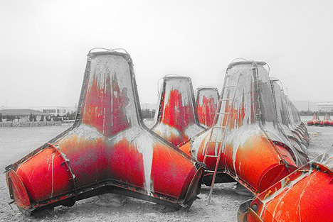
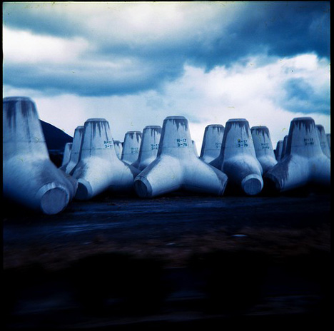
Tetrapod molds -- Location unknown (Photo: Toru Aihara)
Location unknown (Photo: electricnude)
Location unknown (Photo: takay)
Location unknown (Photo: saksak)
[Images: Flickr photos tagged "Tetrapod" & "Tetrapods"//Further reading: Japan Times, Wikipedia]
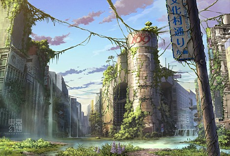
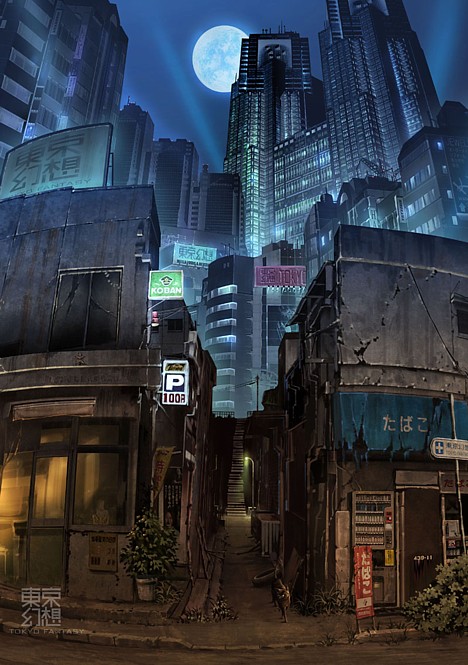
These fantastic photoshopped images by Tokyo Genso (Tokyo Fantasy) show a post-apocalyptic Tokyo overtaken by nature.
Shibuya
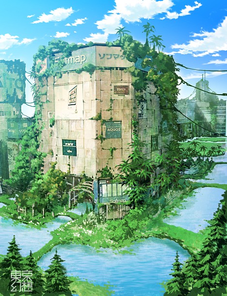
Akihabara
Shinjuku
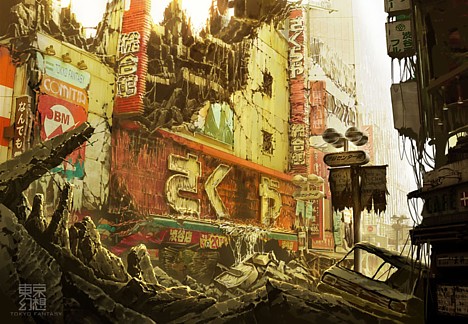
Shibuya Center-gai 1
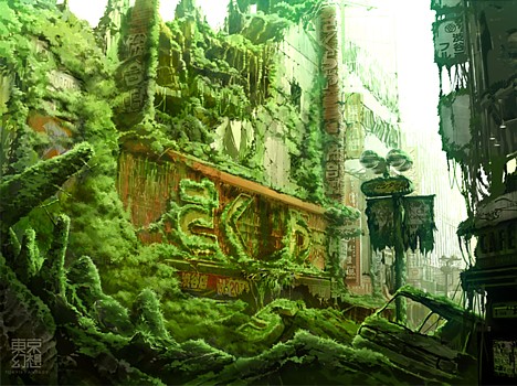
Shibuya Center-gai 2
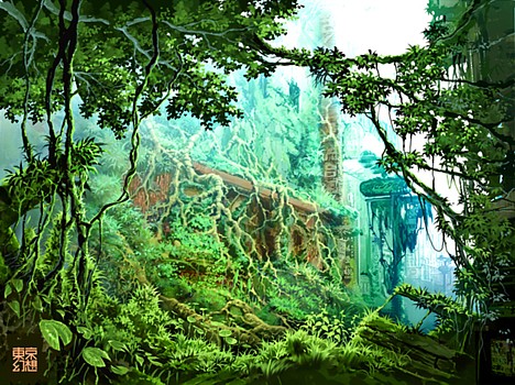
Shibuya Center-gai 3
[Link: Tokyo Fantasy]
Related:
- Neo-Ruins: Lithographs of post-apocalyptic Tokyo (Hisaharu Motoda)
- Mickey the Knight (Kenji Yanobe)
- PET bottle armor (Kosuke Tsumura)
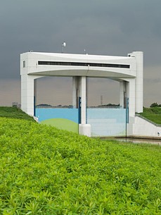
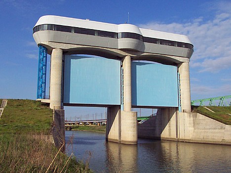
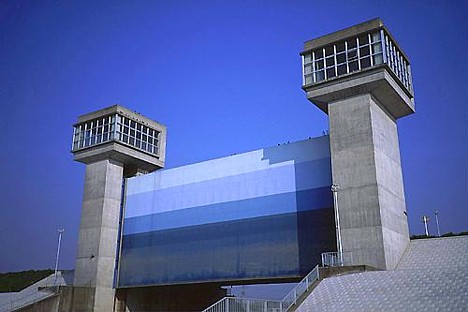
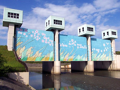
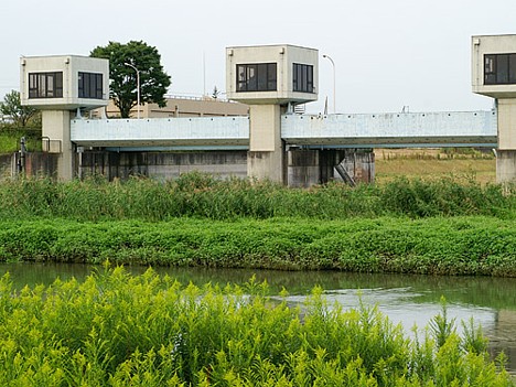
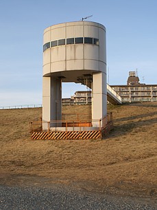
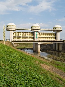
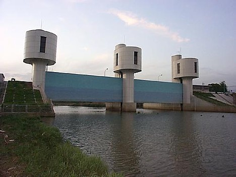
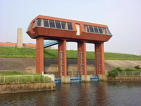
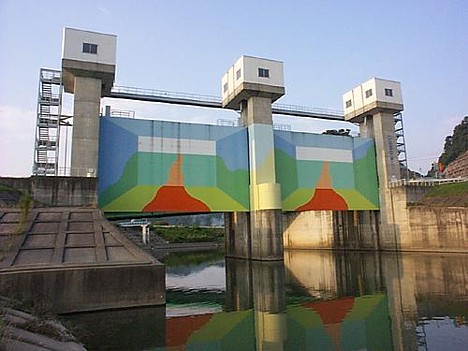
Photographer Sato Jun Ichi explores the architecture of Japan's flood control infrastructure in a huge collection of photographs taken over a period of 10+ years.
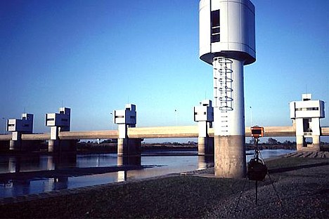
Ibaraki, 1997
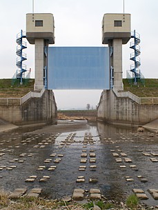
Tochigi, 2006 // Saitama, 2007
Saitama, 1999
Chiba, 1997
Saitama, 1999
Saitama, 2006
Saitama, 2006 // Saitama, 2007
Ibaraki, 1998
Saitama, 1998
Miyagi, 1998
Visit Sato's Floodgates site for about 600 more photos. (Use the links at the top left to scroll through the 37 galleries.) There is also a book.
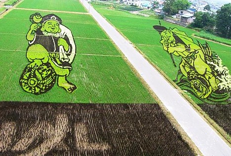
This photo snapped by Aomori-based blogger Pochiko shows remnants of the JAL logo still visible in this year's Inakadate rice paddy art, several days after organizers attempted to "erase" it.
Read more: JAL logo uprooted from rice paddy art